The Ultimate Guide & Map to the Kochi-Muziris Biennale 2025/26 Venues
Kochi-Muziris Biennale is finally here. Browse through Daily Schedules, Highlights, Events, Galleries, Artists in this ultimate guide
Kochi-Muziris Biennale is finally here. Browse through Daily Schedules, Highlights, Events, Galleries, Artists in this ultimate guide

I created a Google Calendar to Keep Track of Events. I update it every 1-2 days. You can click on each and add to your Calendar.

A 200-year-old godown in Mattancherry holds eight of the Biennale's most political works. From Flint's water crisis to the Parliament of Ghosts, Anand Warehouse holds the Biennale's toughest stories
Fort Kochi has a beach everyone visits. But not faraway, there are shores with 500 years of stories and almost no tourists. From a beach that once held Portuguese cannons to a fishing village where nothing has changed in a century Kochi's best beaches aren't the ones on the map.

Most people come to Fort Kochi for the streets. The Dutch houses, the street art, the cafes along historic Street. The beach, if they notice it at all, is something they walk past on the way to the Chinese fishing nets.
That is a shame. Because within a half-hour of Fort Kochi, the coastline holds some of the most interesting beaches in Kerala and almost none of them appear on travel itineraries.
This is a guide to a few of my favorites. Each one is different. Each one has a story.
The beach most people mean when they say "Fort Kochi Beach" is Mahatma Gandhi Beach - MG Beach - a wide seafront promenade that stretches along the Arabian Sea just north of the Chinese fishing nets.
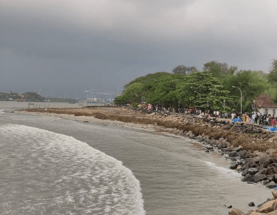
It is not the longest beach in Kerala. It is definitely not the cleanest. But it is the most layered.
What you are standing on was once the heart of a medieval spice port. Arab traders anchored here before the 14th century, drawn by pepper and cardamom from the Western Ghats. The Venetian traveller Nicolo Conti passed through in 1440 and wrote about the place: one of the earliest written descriptions of what would become Kochi. A 14th-century Chinese traveller, Ma Huan, recorded it too, calling it Ko-chih.
The Portuguese arrived in 1503 and built Fort Emmanuel near this waterfront and its the structure that gave Fort Kochi its name. The Dutch took over in 1683 and promptly demolished the fort. The British followed in 1795. Three colonial powers, in sequence, each leaving something behind: a church, a cemetery, a set of fishing nets brought over from China during the time of Kublai Khan.
The beach itself has been shrinking for decades. Locals remember it being three times its current size. Sea erosion and the disruption caused by the Kochi port have eaten away at the sand steadily since the mid-20th century. What remains is still beautiful, but it is a smaller version of what was here.
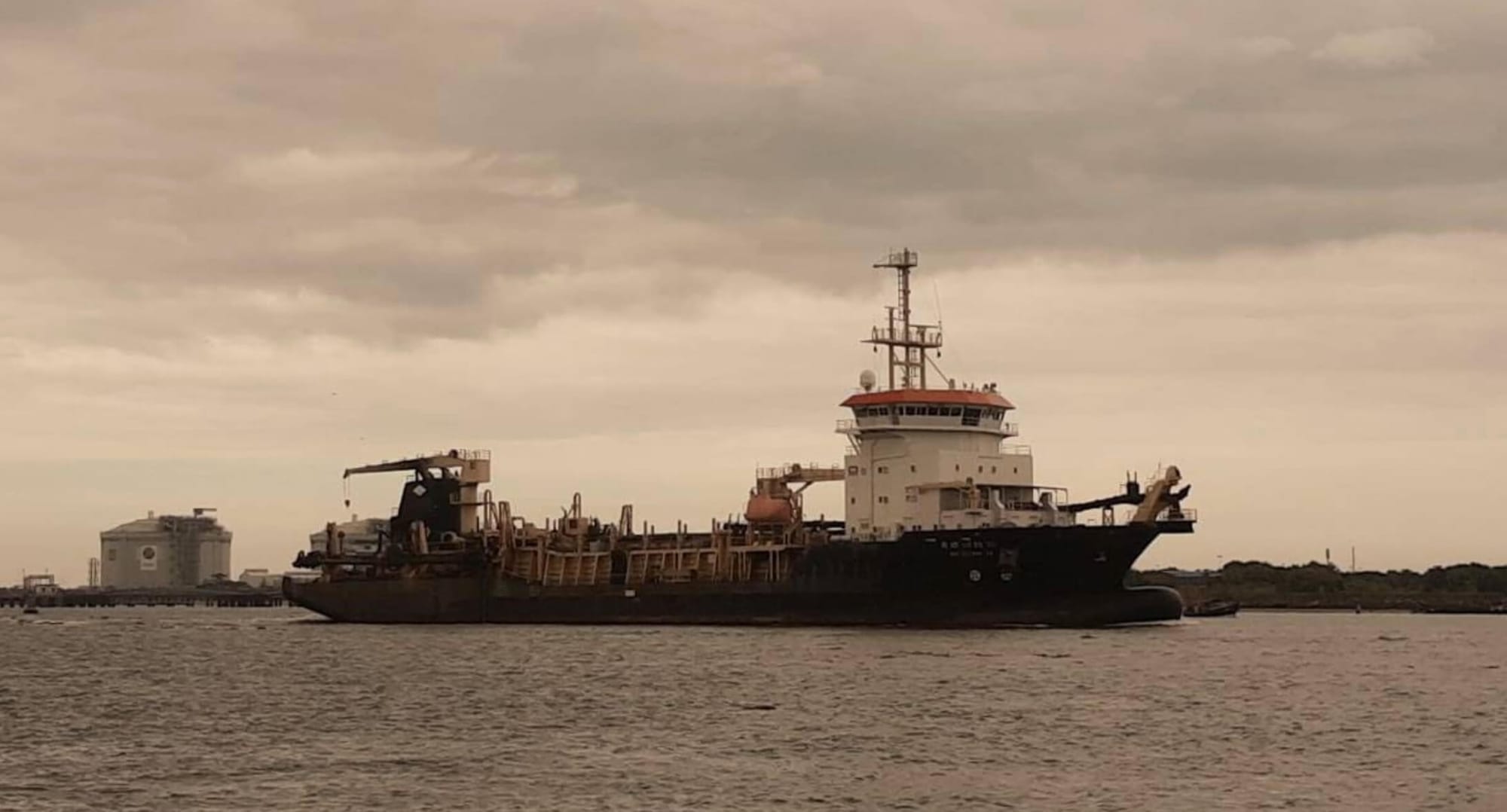
It is also the best spot to watch the big ships pass by. Trust me, it feels like they are just a few meters away.
Getting there: MG Beach is a 10-minute walk from the Fort Kochi bus stand or auto-rickshaw from anywhere in the neighbourhood. Google Maps >
Vypin Island did not exist before 1341.
A catastrophic flood that year destroyed Kodungallur, the major port to the north, and reshaped the entire coastline. The floodwaters carved out a new channel. A new island was born. A new port, Kochi : emerged in its wake. Vypin was part of that reshaping, a 27-kilometre strip of land that now sits just across the water from Fort Kochi.
You reach Vypin by the Vypeen ferry from Fort Kochi is a short ride, less than ten minutes, that feels longer because of everything you see: the container port to one side, the fishing boats below, the water between you and a completely different pace of life.
The island has several beaches. Three are worth knowing about.
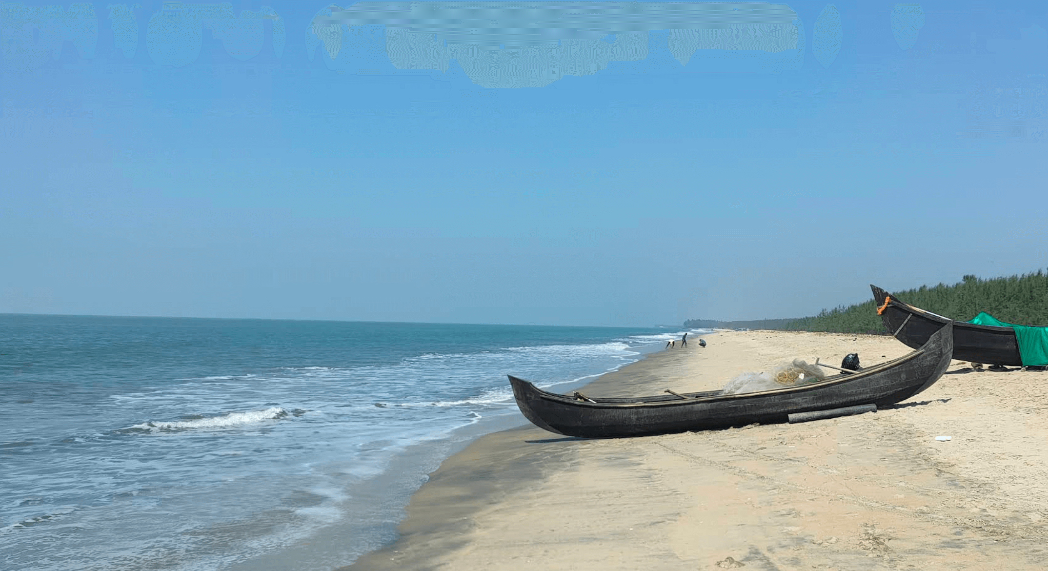
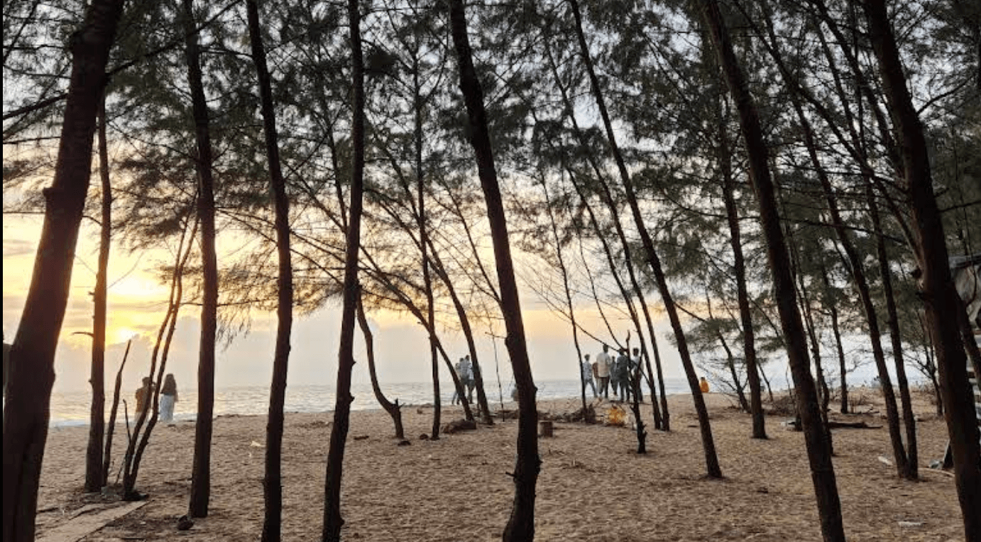
Near the southern end of the island, Valappu Beach is where Vypin's quietness is most concentrated. Fishing nets dry on poles. Boats sit on the sand. There are no food stalls in rows, no hawkers, no entrance gates. Just the beach and the Arabian Sea and the occasional heron.
It is the kind of place that feels accidental as if you have walked into someone's backyard and they have generously decided not to mind.
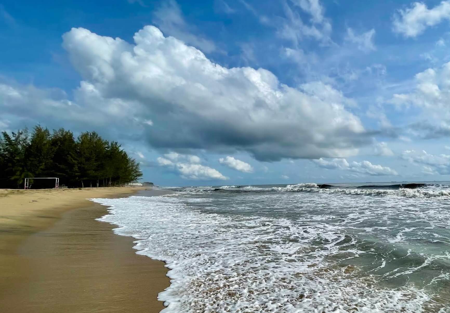
Puthuvype is the most visually striking stretch on Vypin. The reason is the lighthouse, a tall red-and-white concrete tower that stands at the beach's edge, the tallest lighthouse in Kerala. Its beam was transferred here in 1979 and has guided ships through the Kochi channel ever since.
The beach below the lighthouse is wide, clean, and almost always less crowded than MG Beach. Bring a book. Come in the afternoon when the light hits the tower at an angle and everything looks briefly like a painting.
This clean, quiet beach is an ideal picnic destination. It offers a relaxing vibe, a few handy food stalls, and a beautifully maintained environment, making it a popular, peaceful spot for families and couples to unwind.
Getting there: Take the Vypeen ferry from Fort Kochi Jetty (runs regularly, costs a few rupees). Puthuvype is a few kms from the ferry landing, auto-rickshaws available.
About 12 kilometres from Fort Kochi, between Chellanam and Kochi, Puthenthodu Beach is half a kilometre of sand that most travellers drive past without stopping.
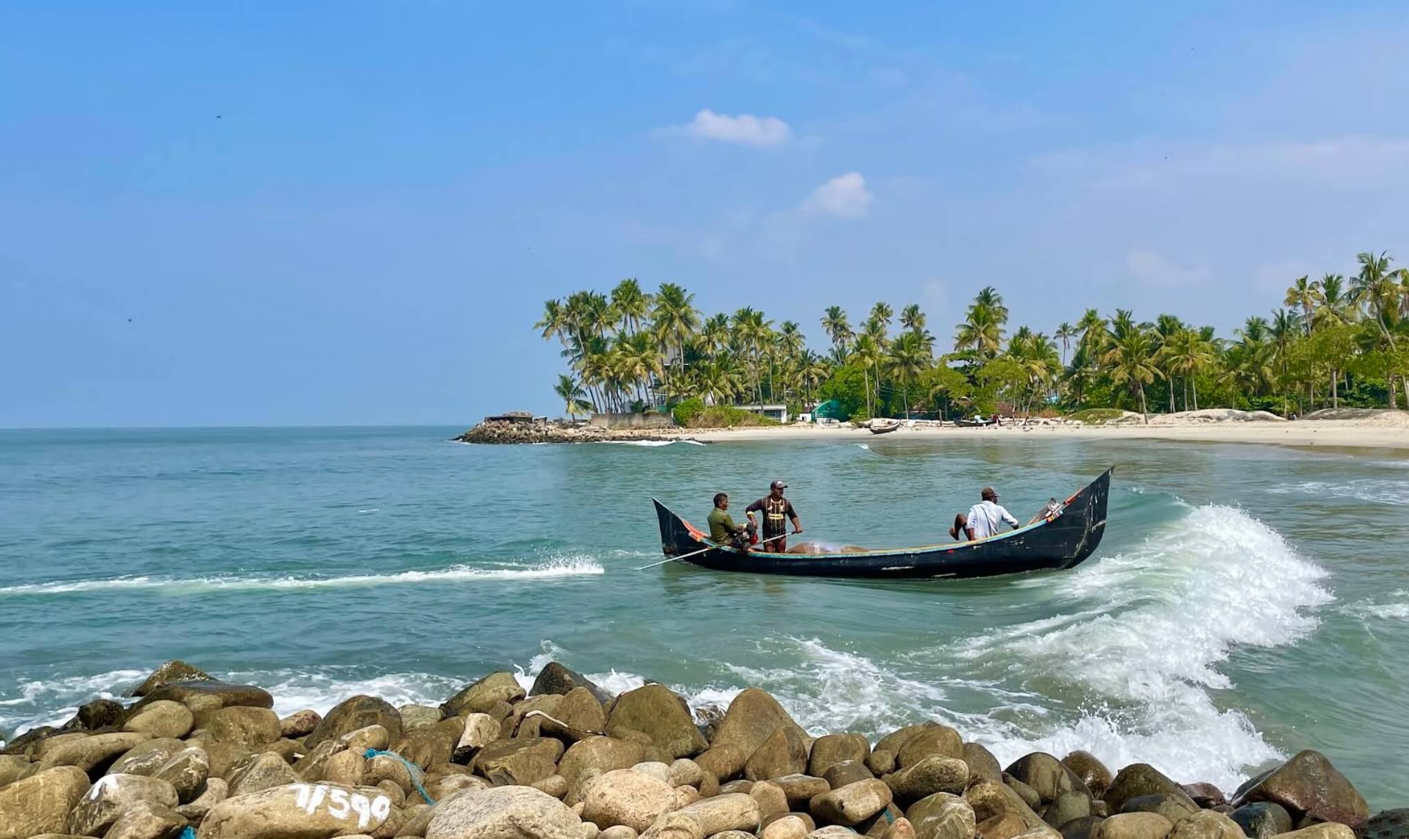
There is no entry fee. There are no crowds. The beach is clean, the sand is fine, and the fishing boats anchored offshore give it the kind of unposed quality that is becoming harder to find on the Kerala coast.
Puthenthodu sits on the historic Malabar Coast, a stretch that saw Arab traders, Portuguese captains, Dutch merchants, and British administrators all pass through at different points. The beach itself carries no monument to any of this. It simply continues to exist, as it always has a place where the sea comes in and goes out, and the fishermen get on with their work.
Getting there: 12 km from Fort Kochi. Best reached by auto-rickshaw or taxi. No entry fee, open all hours.

Do you need someone to help you visit this place? We are Cuber - a fun hyper local "Uber" run by cats to connect you with local cab/taxi drivers.
Chellanam is not a comfortable story. But it is one of the most important ones on this stretch of coast.
Three kilometres of sand once separated the sea from the villages here. That gap is now measured in metres, in some places, the sea has reached the walls of people's homes. More than 15,000 people living along Chellanam's 17.5-kilometre coast have faced erosion, flooding, and displacement, some of it every monsoon season.
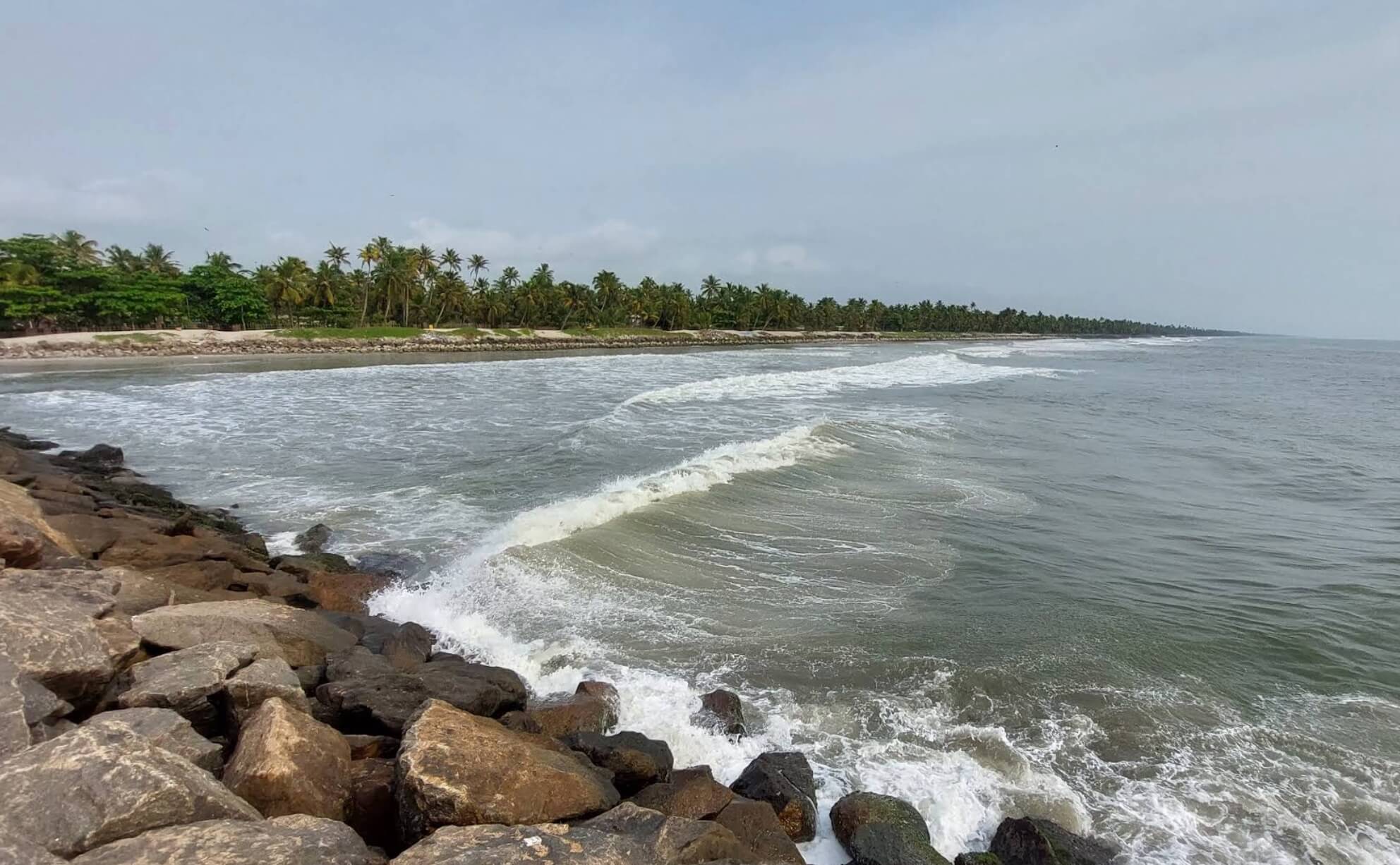
The causes are contested but documented. Sea erosion in this area intensified after the construction of the Kochi port in 1926. The shipping channel disrupted the natural movement of sand along the shore. A harbour built here in 2010 made things worse. Cyclone Ockhi in 2017 took out 700 homes in a single event. The Kerala government classified the area as "highly susceptible to coastal erosion" as far back as 1986.
For decades, the seawalls that were meant to help either failed or made the problem worse elsewhere along the shore.
And then, recently, something changed.
A 7.35-kilometre tetrapod seawall, reinforced with groynes, was completed after years of delays. Nearly 120 families who had been displaced have been able to return. Land prices in Chellanam, which had collapsed, are rising again.
It is not fully resolved. The sea does not stay resolved. But the beach that emerges here, south of the old village, is a place where you can see what coastal resilience looks like up close.
Chellanam is not a beach you visit to relax. You visit it to understand how the coast actually works, and what happens when we interfere with it.
Getting there: About 14 km south of Fort Kochi. Take a bus or taxi towards Chellanam. The beach area is accessible from the coastal road.
The beaches listed here spread across roughly 10-15 kilometres of coastline. You are not going to visit all of them in one day, and you probably should not try unless you are wonder-woman.
A good two-day plan: Fort Kochi Beach and a Vypin day-trip on day one. Chellanam, Puthenthodu on day two. The ferry to Vypin runs frequently and costs almost nothing. For the southern beaches, a hired car or scooter gives you the most flexibility.
Do you need someone to help you visit this place? We are Cuber - a fun hyper local "Uber" run by cats to connect you with local cab/taxi drivers.
You may also like

Kochi-Muziris Biennale is finally here. Browse through Daily Schedules, Highlights, Events, Galleries, Artists in this ultimate guide

I created a Google Calendar to Keep Track of Events. I update it every 1-2 days. You can click on each and add to your Calendar.

A 200-year-old godown in Mattancherry holds eight of the Biennale's most political works. From Flint's water crisis to the Parliament of Ghosts, Anand Warehouse holds the Biennale's toughest stories

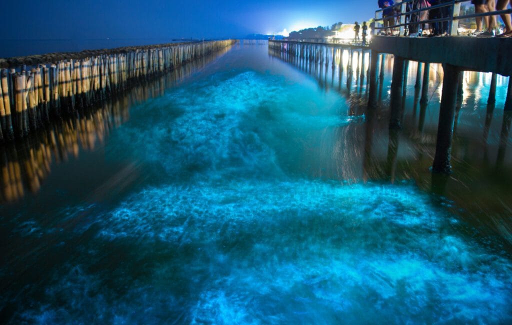
Every summer, the water near Kochi lights up electric blue. Here's the science behind it - It's not magic. It's not a filter. Tiny creatures in the water near Kochi make their own light. Here's how.
